
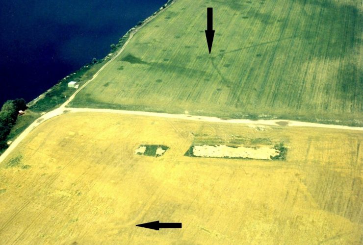
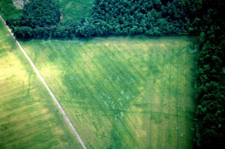
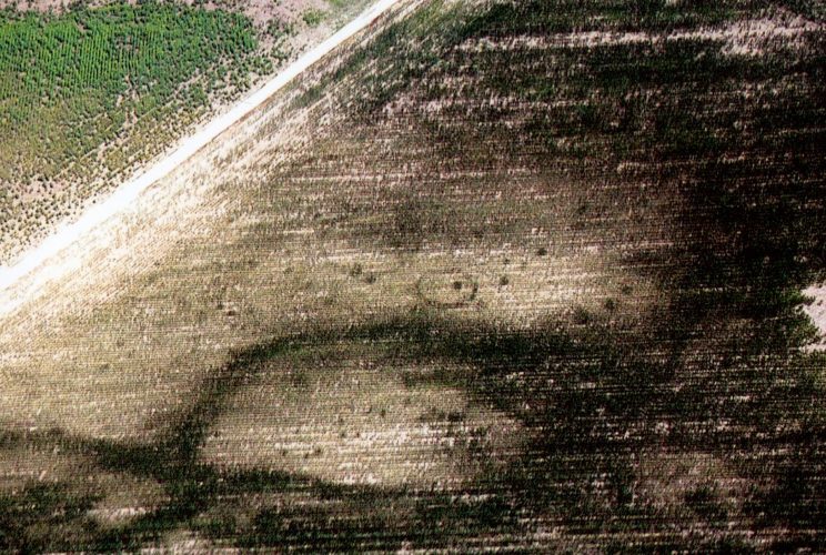
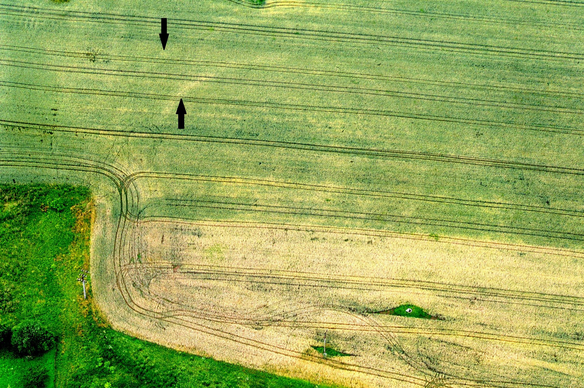
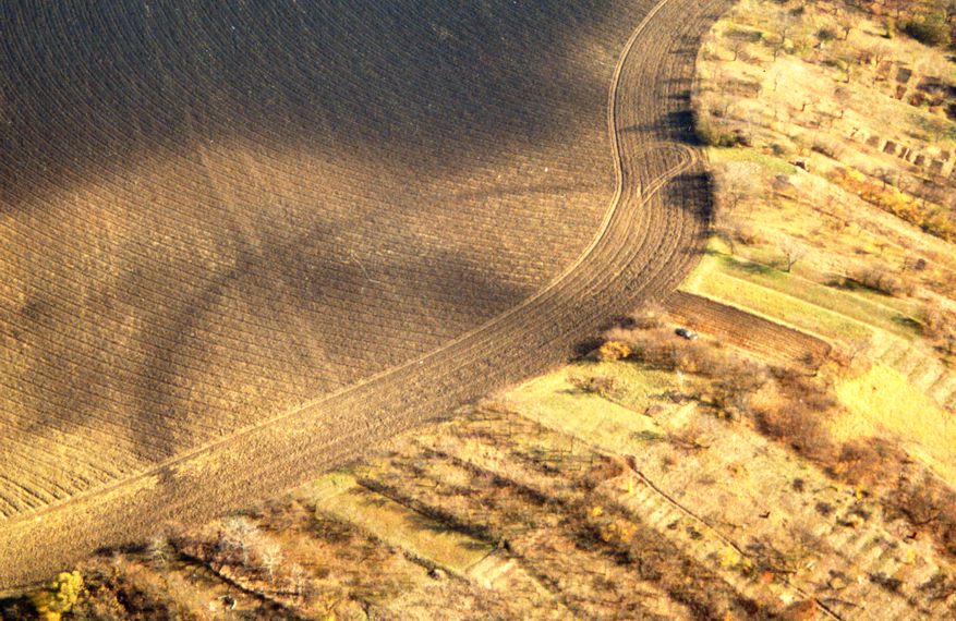
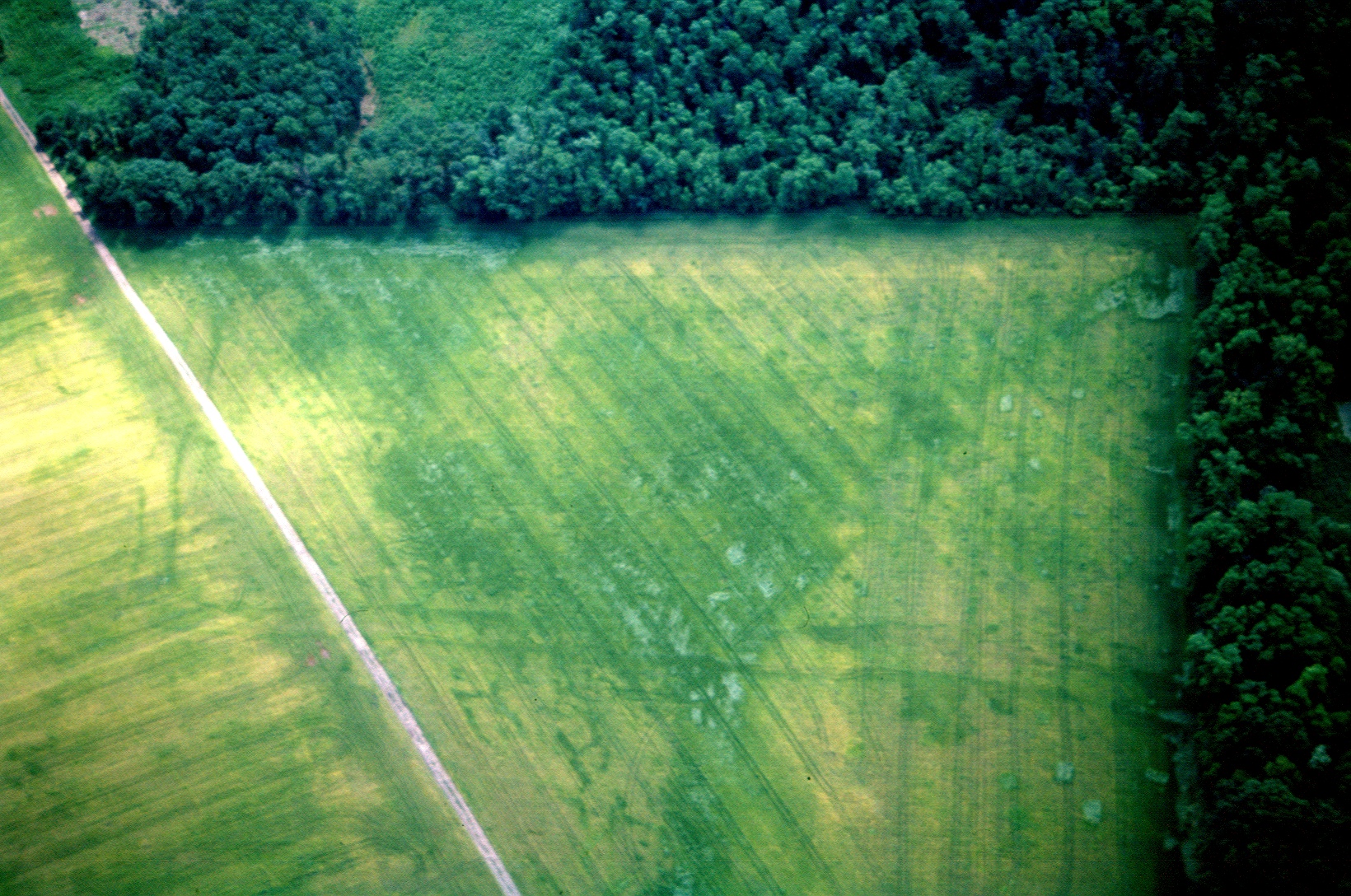
One of the specialisations in research and education at the Department of Archaeology at the FF UHK is aerial archaeology. The Department’s activities in the field of aerial archaeology are associated with the personality of J. Kovárník. He initiated a systematic aerial survey and aerial photographic documentation of archaeological sites (at his then workplace in the South Moravian Museum in Znojmo) as early as 1982, as the first professional in former Czechoslovakia and in the countries of Central and Southeastern Europe. The methodology of aerial survey is based on different kinds of crop marks, where any man-induced disturbance of the soil manifests itself in the appearance of the landscape. In this way, J. Kovárník discovered a number of important sites, such as the first camps of Roman troops in Moravia (Fig. 1) near the flooded village of Mušov, Brno-Country District, in 1991. The discovery of a chain of strongholds used by Roman troops in southern Moravia (e.g. Charvátská Nová Ves, Šakvice, Mušov and others) 90 km or more north of the Middle-Danubian limes was considered as one of the important discoveries of the 20th century. A phenomenon characteristic of the Late Neolithic period are sites with roughly circular, sometimes even multiple ditches, the so-called rondels (ø 50-100-240 m and more) with entrances oriented approximately towards the cardinal points. These were places used for activities connected with the organisation of society and cult. Aerial prospecting has increased the number of rondels in Moravia (such as Vedrovice, Znojmo District, Rašovice, Vyškov District; Milovice, Břeclav District, etc.) and in eastern Bohemia (Semonice, Náchod District, Lochenice II: Fig. 2, Chlum, Hradec Králové District, etc.), as well as of irregular circular rondeloids of the Early Bronze Age (Lanžhot, Vranovice, Břeclav District, etc.). Other discoveries include oval or arch-shaped ditched fortifications of the Únětice culture (Kyjov, Karlín, Hodonín District, Mušov IV, Brno-Country District, Vážany nad Litavou: Fig. 3, Vyškov District, etc.), including multiple ones (Hrušovany n/J, a diameter of 206 m). Many prehistoric to early historic settlements have been documented as well, including deserted medieval villages (Třesice, Hradec Králové District), some of which were even fortified (Libice: Fig. 4 near Břežany, Znojmo District), ground plans of houses (Kosice, Hradec Králové District, Jevišovka, Rakvice, Břeclav District; Božice, Hrušovany n/J, Kyjovice, Znojmo District, etc.), graves and cemeteries (Rakvice, Břeclav District; Oblekovice near Znojmo). Some important tombs appeared as circular or square furrows (Mušov, Strachotín: Fig. 5, Břeclav District; Borotice, Znojmo District, etc.). As early as 1983, enclosed settlements dating from the beginning of the Neolithic near Vedrovice, Znojmo District, were documented. In the following years, other prehistoric (a rectangular ditched enclosure at Božice, Derflice, Znojmo District) or historic fortifications were documented.
CONTACT
doc. PhDr. Kovárník Jaromír, CSc.
e. jaromir.kovarnik@uhk.cz
t. +420 493 331 269


