
Research topics connected with investigations of the individual components of historical cultural landscape are pursued by the Department of Archaeology at the FF UHK. In the first place, these are investigations of ancient roads, water works, abandoned field systems or places associated with executions. The investigations are especially carried out on a non-destructive basis. Standard remote sensing of the Earth’s surface and methods needed for the identification of relief features are used. Apart from archaeological methods, also research of written, cartographic and iconographic sources is employed to investigate the above themes. Its aim is to interconnect partial research topics and gain a complex picture of the (Eastern) Bohemian landscape in the 13th-19th centuries.
CONTACT
Mgr. Pavel Drnovský, Ph.D. Mgr. Petr Hejhal, Ph.D.
e. pavel.drnovsky@uhk.cz e. petr.hejhal.2@uhk.cz
t. +420 493 331 274 t. +420 493 331 274
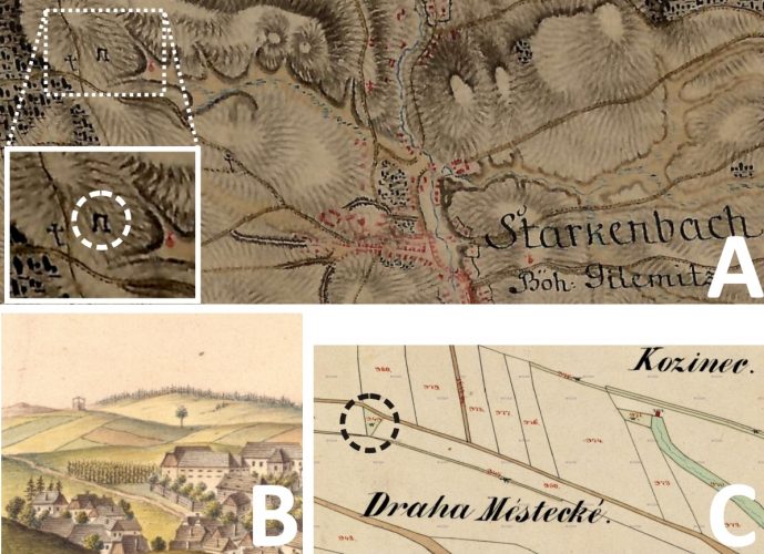
obr. 1
Jilemnice: příklad využití různých kartografických a ikonografických pramenů k lokalizaci popraviště.
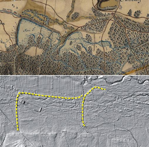
obr. 2
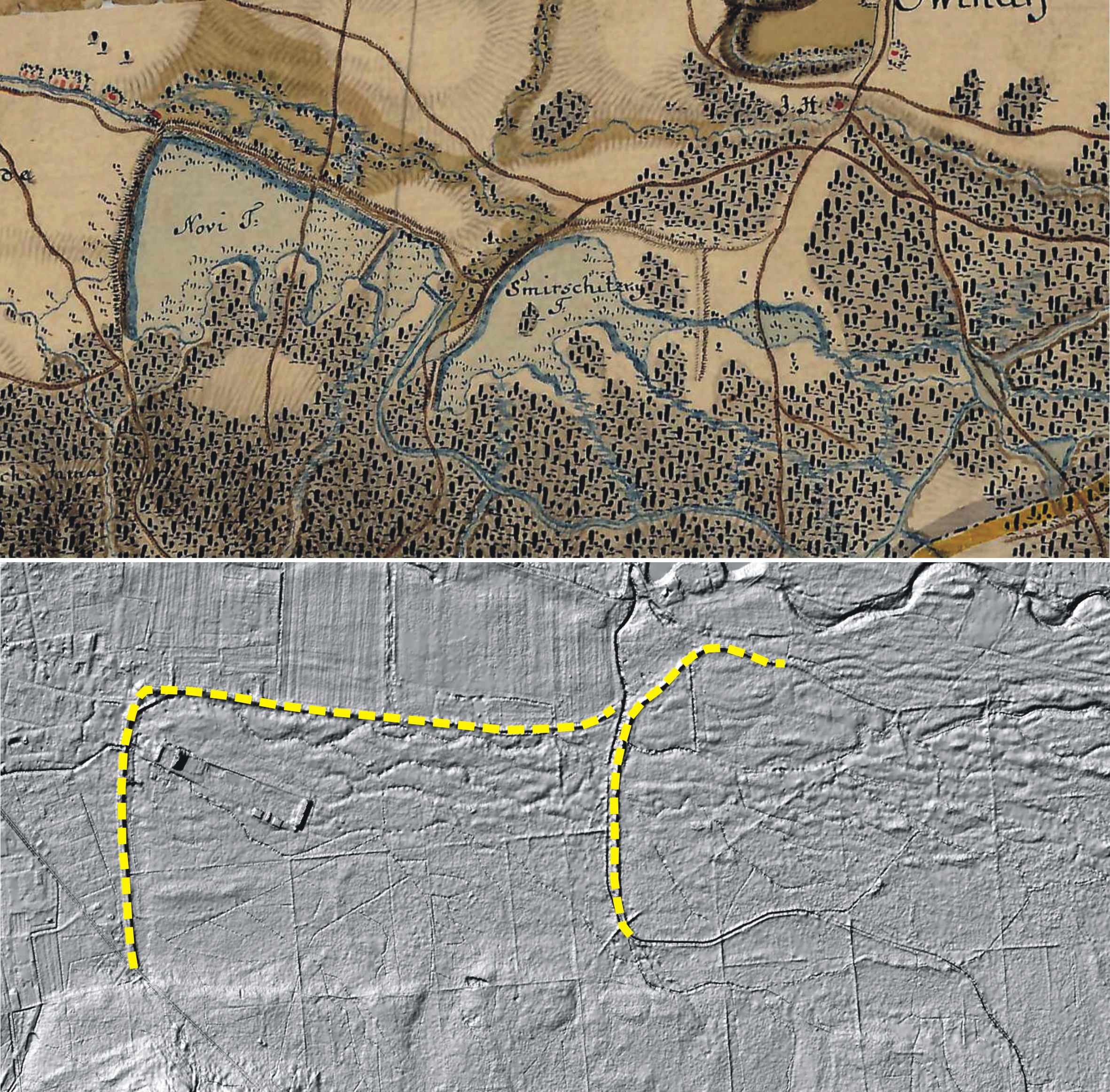
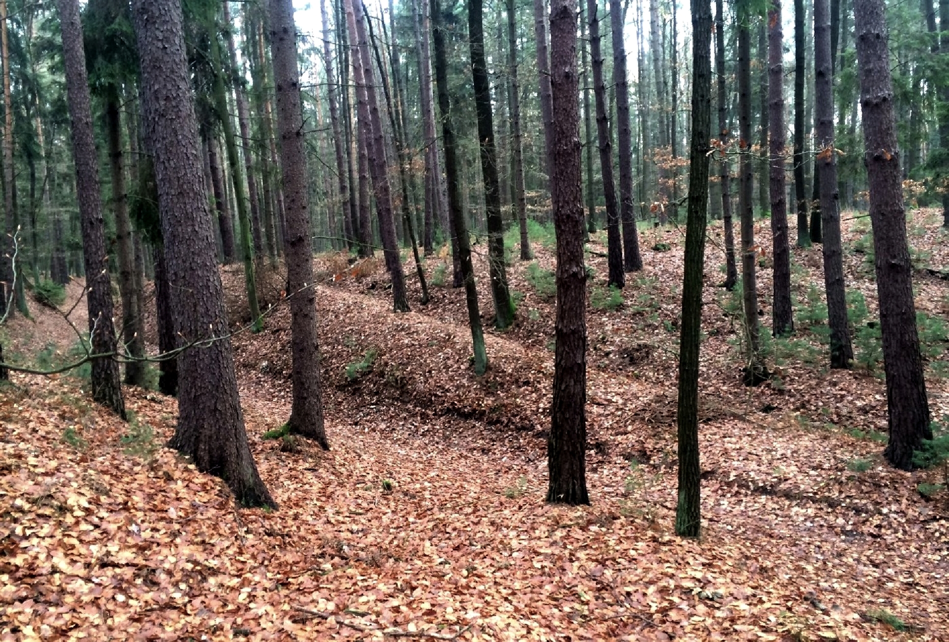
Hradec Králové, Nový a Smiřický rybník zakreslený na 1. vojenském mapování. Oba rybníky se nacházely jihovýchodně od královéhradecké městské aglomerace. Dnes jsou obě vodní díla zaniklé a překryty lesním porostem. Na výškopisném modelu reliéfu jsou patrny hráze obou rybníků. Mapové podklady: http://mapire.eu; http://ags.cuzk.cz/dmr/;© ČUZK)


